Our Service Portfolio
Explore what we offer:
When you work with us, you get the benefits large-firm know-how while still having direct access to the experts who will work with you every step of the way on your project. You will experience clear communication and excellent service throughout the project life cycle, and you’ll receive highly detailed and reliable survey deliverables as we wrap up the project for you. Please reach out to us; you will be glad that you did!
The primary types of survey services we offer are detailed below. Subsets of these services that we provide would include subdivision and lot-line adjustment surveys as well as elevation certificates. For exceptionally detailed topographic surveys we can also provide 3D laser scanning services.
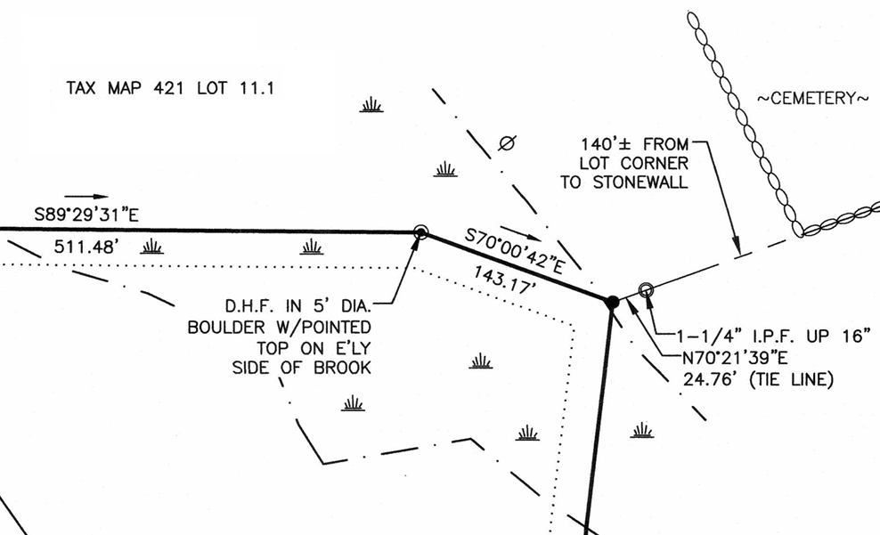
A parcel of land you own could be thought of as a puzzle piece, surrounded by puzzle pieces (parcels) owned by others. A boundary survey begins with extensive records research to identify how & when a given parcel was created, and how & when the surrounding parcels were created, and what rights are associated with those parcels (e.g. easements benefitting others to run utilities across the parcel). The next step is extensive research on the ground to locate the features that are called for in the various written records as delineators of ownership, etc. This is followed by a precise field survey of those features using a variety of survey equipment to measure the angular and distance relationships between those features. Finally a plan (a map) is produced showing lines with bearings and distances around the perimeter of the parcel of land along with descriptions of the “monuments” (e.g. granite bounds, iron rods, centers of streams, etc.) located along the lines and/or at the ends of those lines and also showing the locations where easements are located (if there are any easements).
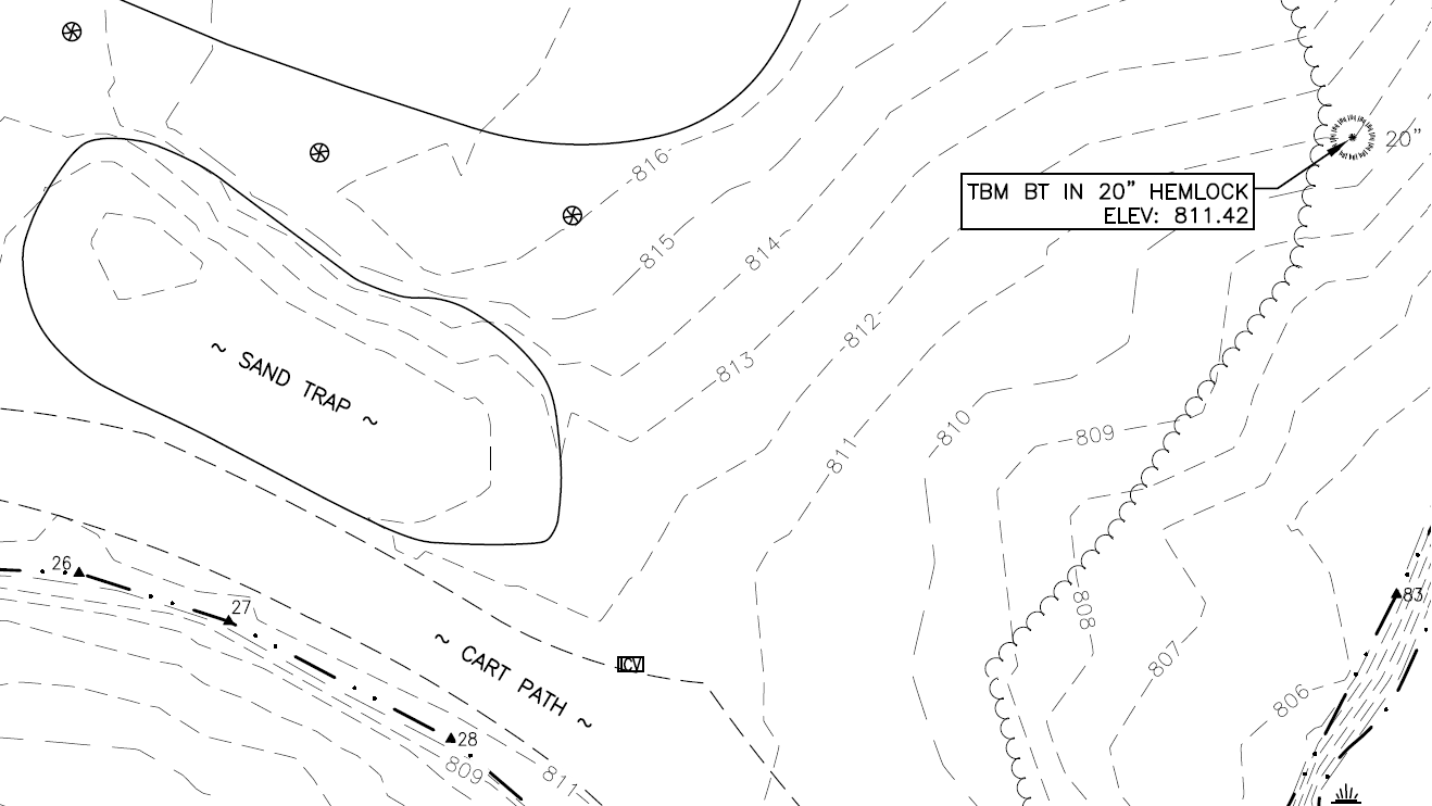
Topographic surveys capture the “lay of the land” and the many features existing on that land such as buildings, roads, trees, stonewalls, utilities, etc. We show these features on maps where the elevation changes across the land are represented by contour lines. These types of surveys generally show a lot more details about what is on a parcel of land, but they are not intended to capture details on the boundaries of a property. Topographic surveys can also be performed below water; for example to capture the “lay of the land” at the bottom of a lake or pond. We have a variety of equipment (including a remote-controlled boat fitted with an echo-sounder) to perform bathymetric surveys safely and efficiently.
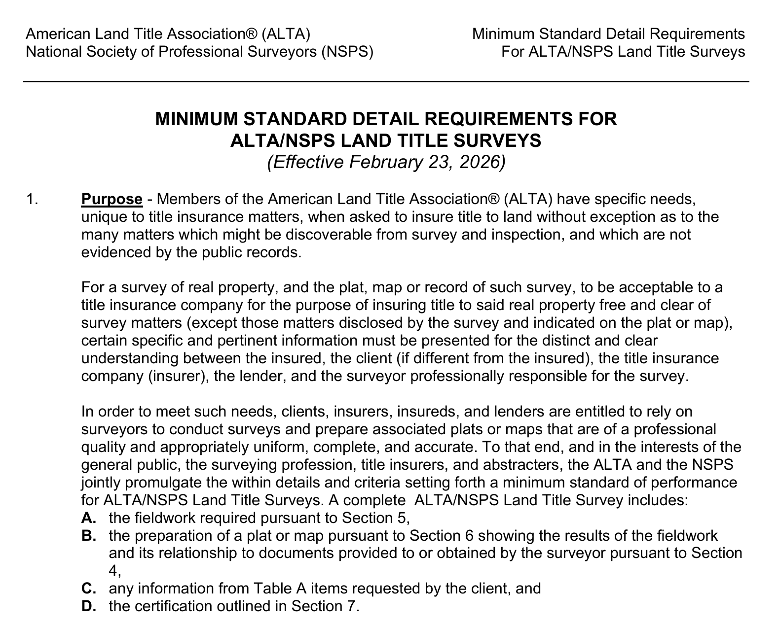
These are specific surveys designed to meet the requirements of the American Land Title Association (ALTA) and the National Society of Professional Surveyors (NSPS). These types of surveys are primarily used in commercial real estate transactions, and they provide a clear and legally comprehensive picture of a property. They combine elements of boundary surveys and topographic surveys along with title searches and they are an exceptionally valuable tool for use by real estate buyers, lenders, and title insurers.